Monday, 13 May 2013

The Tebay Lad and Geordie Lass Relax on Beach


We had previously done a cycle tour in Andalucia  and decided on  a week's holiday in the sun.  After seeing Mceff's blog about the Sierra Nevada   (  http://becausetheyrethere.com/2012/10/04/lucero-where-old-hatreds-linger/#more-5195)  we ended up in the Hotel Alcadema in Lanjaron.


Monday we headed for the trail head below the Cuerda del Travenque ridge.


The city in the background is Granada.


The heat was reflected by the white limestone scree but we had 4 litres of water between us.


We round a bend and the hill seems a long way off,  it's the Cerro del Trevenque 2083m.


We alternate between the ridge and a broad path just below the crest.


A local bloke with his dog overtakes us as we head up the steep bit for the summit.


At last the summit with the high Sierra beyond and a baguette to chomp.


We had come up on the right of the picture and are going to descend the white scarred ridge in the centre and then down the waterless valley , over the col and back to the car.


This is a good way down as the river bed is dry and easy to walk on.


So the relaxing on the beach........

The day after the walk we had a day at the coast.  I took my shirt off to dazzle the onlookers and managed 10 minutes on this rock.  We then had a paddle and headed for the hills.  I know everyone is different but we passed some sun beds with brown prune like bodies lying on them.  How the hell anyone can just lie there for hour after hour is a mystery.


Sunday, 28 April 2013

Borrowdale Pink Rock


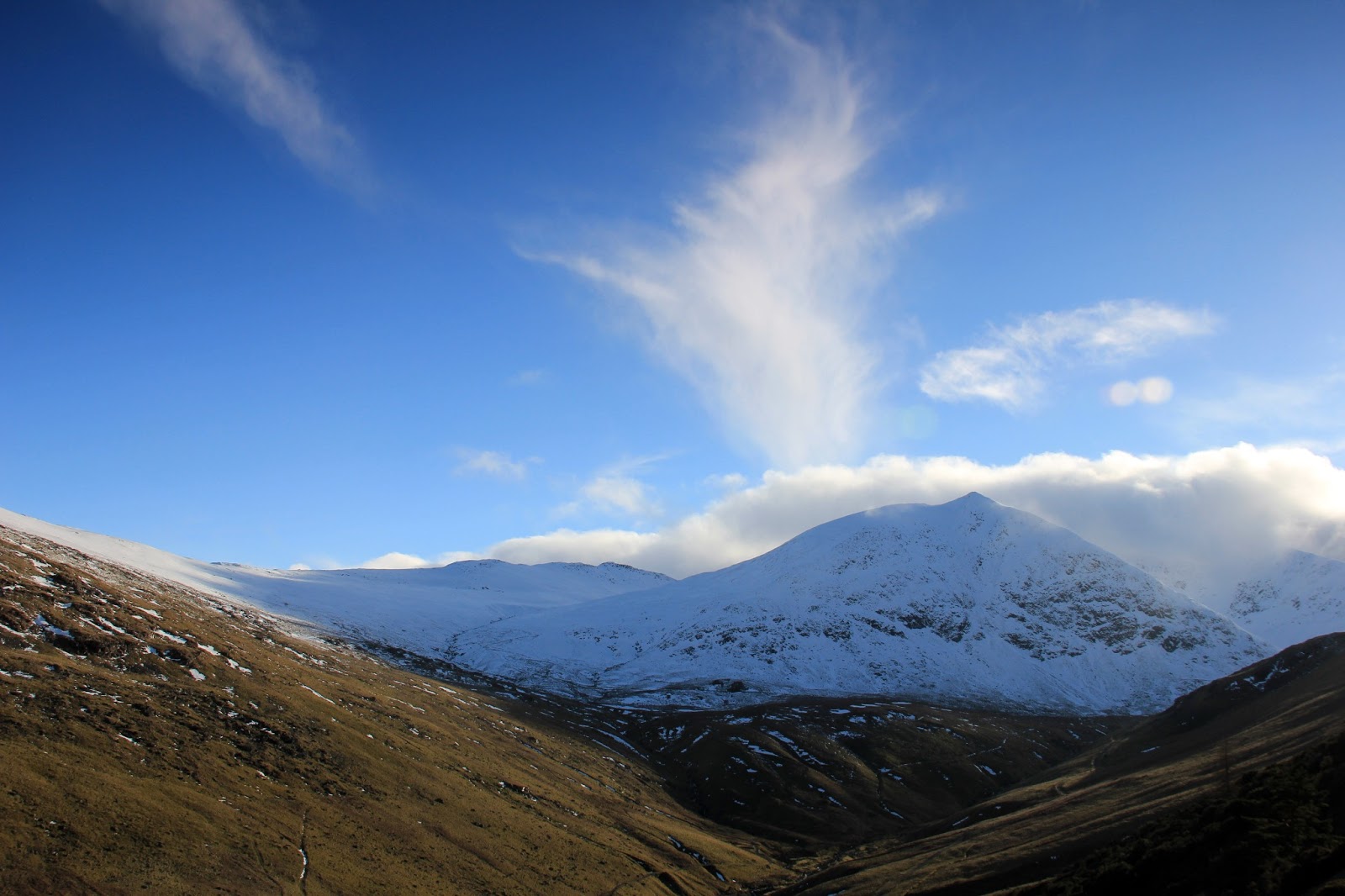
After a mad dash after work and a call to Penrith Morrisons I park the car outside my mam and dads at 20:15.  That'll give me just over an hours daylight to reach Borrowdale, climb the  Whinfell ridge and get the tent up. Borrowdale is a side valley going right in the above picture just below the snowy fell.


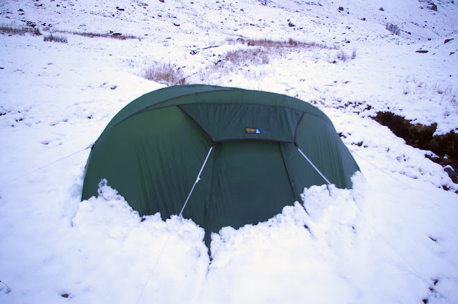
I got the tent up at 22:00.  I carry 4 litres of water up from the beck and get the tent in the lea of a wall.
I brew coffee in the morning and the snow is already melting.


Daylight and I'm glad of that wall as the wind is strong.  I aim to walk along the ridge in the left of the picture and come back down the valley.  There's a couple of things I want to see.  If you look at Whinfell Beacon from the south there is a wood very near the top.  Wainwright reckons this was planted to provide wood for the beacon.  I'm on a mission to check it out.  There's the mystery of the pink rock.  I used to fish this valley 40 yrs ago and remember seeing pink rocks in the beck that weren't Shap Granite and certainly not the silurian mud stones of the local geology.


The wood is beautiful, the trees old and twisted.  Someone went to a lot of trouble as there is the remains of a drystone wall all the way around. The trees are not regenerating as sheep are in there now.
How long ago where beacons used ?  Are these trees that old?  They are only a short walk from the summit.


Back on the ridge I look back at the way I've come.  I'd camped just to the left of the far radar aerial.


Eventually I reach the A6  and do a sharp right back down the valley. 


Not far from here is where we once had a youth club barbecue.  One of the lads pulled a big salmon out of the beck and took it home for his mam. 


When  I sit by the beck for lunch I look for the pink stones.  They are visible in the photo above.
I hadn't imagined it, but the mystery remains they are dark pink but dont have the big crystals of the Shap Granite.  They are heavy and very tough to break.  More research needed.


It's just a question of heading over the ridge to Roundthwaite and then on to Tebay.


Just for a change it looks like rain in Tebay.  I can see my mam and dad's house from here.


Lune valley and Howgills behind.


Coming down to Roundthwaite with Tebay behind.  Just the motorway and railway to get through.


  I can remember before this was built.
Further on there are fences where there never used to be and the  little streams where the sticklebacks were are gone.  There used to be ponds near the river with newts in, no sign. There were reads next to the bridge with water rats,  just grass and trees now.


The street above used to have a cake shop and cafe, a post office, a coop,  an electrical shop and a drapery and I knew everybody's name.
Mind you they do have street lights now and indoor toilets.


Monday, 18 March 2013

Lake District Ski Club


It's raining and there's only 2 other cars in the car park at Greenside Mine.  I've rung the snowline and Bernie's reassuring voice has told me the tow will be running so I head slowly up hill.


The car park at the youth hostel is full of cars as people head for Helvellyn.


Heading towards the chimney I spot a figure in the distance heading the same way.


The skies clear a little to reveal the much underrated Catstye Cam.


The snow is quite deep on Raise as I round the corner and see the tow ahead.


I get changed in the hut and try to dry off my sweaty face and steamed up glasses before heading for the top to make some tracks.


The club hut and tow.

Cool shades.

At the end of the day I take the tow to the top and ski down the ridge.  The idea is to get as far down as possible to save carrying the skis.


Two other members manage to ski across heather and get 50 yards lower than me.

It's just a struggle down the steep hill to the car with a wonderful view back up the valley.


Monday, 11 March 2013

No Added Sugar


Sunday I'm off to see my mam in Tebay so the walk has to be Saturday.  It's overcast and the higher fells look like they have fresh snow disappearing up into the mirk.  I'm the second car in the car park at Chapel Bridge, Little Town.  I follow two blokes heading up beside Scope Beck.


I've chosen this route as I have only ever looked down on this valley from the ridges above.  One of the big motivations  for me is seeing what's round the next corner. With that in mind I follow the beck up rather than the path.


At a slanty waterfall I have to bale-out up a gully to the right.  The grass is steep so I'm careful as no-one knows I'm here and a slip might be awkward.


Regaining the beck above the impass I make a note to come back in summer and see if its possible to scramble up the falls.  Having said that I'm always spotting crags I want to climb, corries I want to camp in, gills I want to explore....


Above the falls it broadens out into  a flat hanging valley.


I  sit behind the wall of a sheep pen to eat my dinner.  The fruit sandwiches might not have been the best idea.   The ultimate (no added sugar) jam.


Up on Littledale Edge it's a bit wild.


I drop down the side of Tongue Gill, in a hurry now as I'm supposed to be fitting a bathroom light switch for a customer in the afternoon.


Stayed on my feet all day only to do a head first as I'm walking down the track back to the car.


Wednesday, 6 March 2013

Scafell Pike


Overcast but no wind as I drive along Wastwater.  It's been a long time since I tackled Scafell Pike from this side via Hollow Stones and Mickledoor.  I usually do the Corridor Route or from (in my opinion) the best route from a camp beside the Great Moss in Eskdale.


As I get ready at the car park an old timer like me sets off with full winter kit whereas some young lads in the next car have neither axe nor crampons.  As I approach the back wall of the corrie I put on the gear.  Most people have headed for the easier route from Lingmell Col.  I eat a Greggs bacon sandwich purchased in Egremont and watch as a couple struggle up the slope in bendy boots.  The route follows the slanting gully at the lowest point on the skyline.


On the ridge there are 3 lads eating chocolate in full gear plus helmets.   They 've  come up the same way as me and are outraged by the couple in the bendy boots who were apparently on all fours and just made it because of the bucket steps in the nevee from previous walkers.
Not one for paths I head off right walking over a completely drifted over Broadcrag Tarn and some easy snow ramps to the summit.


I sit in the lee of the summit and feed a chicken sandwich to a beautiful raven.  About 30% of people on the top have the correct gear for snow and ice.


I head for Lingmell, there are crowds coming up this way.   Mostly without gear and slipping on the steeper slopes just before the plateau.  There's even a couple in shorts.  No wonder the press have a field day when there's an accident.


As I walk down the Lingmell ridge,  boy does that do your knees in,  I look across at the ascent route and remember in my holier than thou outrage  that actually for the first 20 years of my walking career I probably didn't have crampons either.  Nowt worse than a hypocrite !


Talking of hypocrite I'd better not call at a caf on the way home as  I've already had a bacon sandwich and I'm supposed to be on a diet.